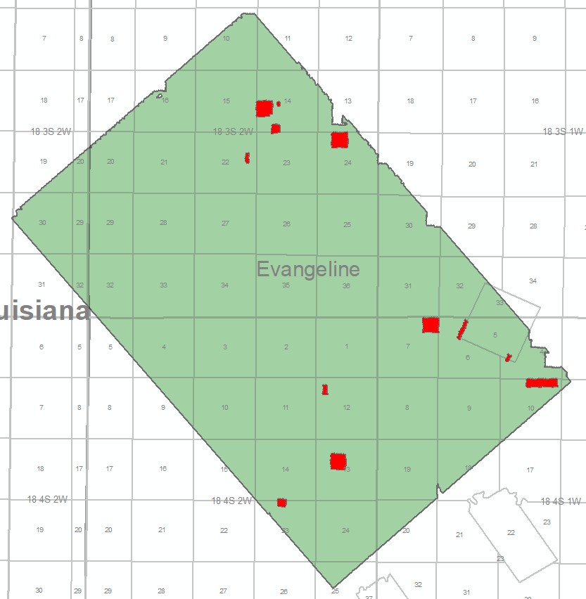
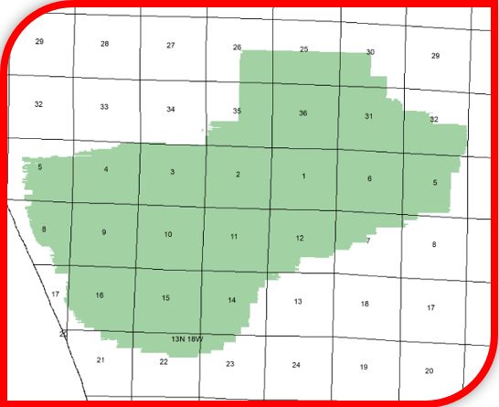
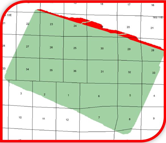
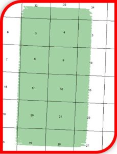
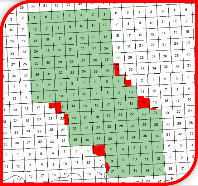
Seismic Exchange, Inc. is pleased to announce the release of the 3T 3D survey, which comprises 42.19 square miles located in Allen and Evangeline Parishes, Louisiana, that was recently acquired from Ventex Operating Corp. and is currently available for licensing.
3T 3D – 42.19 square miles
Additional information and shapefiles are available upon request or by visiting our interactive map at www.seismicexchange.com.
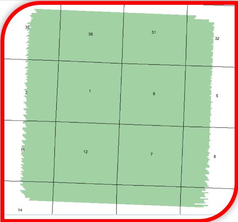
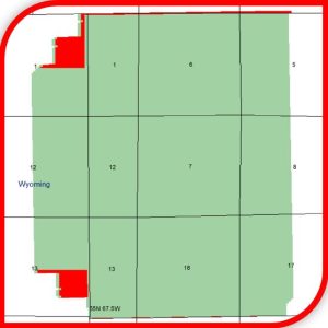
Seismic Exchange, Inc. is pleased to announce the release of the following 3D surveys that were recently acquired from Stephens Production Company and are currently available for licensing.
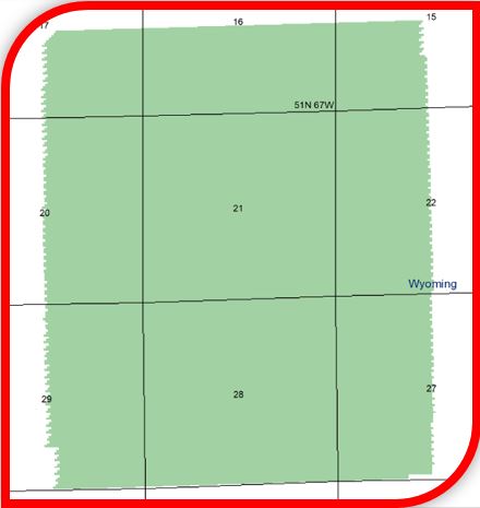
Avalon WY 3D (2018 Reprocessing) – 4.96 square miles/Crook County, Wyoming
Belle Creek 3D (2018 Reprocessing) – 30.45 square miles/Campbell County, Wyoming
Ormsby 3D (2005 Reprocessing) – 30.68 square miles/Natrona County, Wyoming
Ranchero 3D (2013 Original Processing) – 7.10 square miles/Crook County, Wyoming
Benona 3D (2003 Original Processing) – 15.22 square miles/Oceana County, Michigan
Waterdog 3D (2004 Original Processing) – 18.58 square miles/Oceana County, Michigan
Beiceigel Creek 3D (2003 Original Processing) – 9.04 square miles/McKenzie County, North Dakota
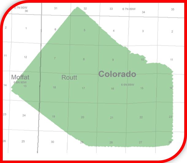
Breeze 3D (2004 Original Processing) – 17.27 square miles/Moffat, Routt Counties, Colorado
Temblor 3D (2018 Reprocessing) – 14.30 square miles/Fresno County, California
Vallecitos 3D (2016 Reprocessing) – 21.79 square miles/San Benito County, California
Additional information and shapefiles are available upon request or by visiting our interactive map at www.seismicexchange.com.
Seismic Exchange, Inc. is pleased to announce the release of the following 3D surveys that were recently acquired from Stephens Production Company and are currently available for licensing.
Flat Lake 3D (1997 Merged Reprocessing) – 96 square miles Sheridan County, Montana/Divide County, North Dakota/Saskatchewan, Canada
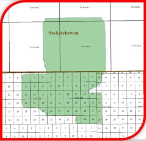
Salt Lake 3D (2000 Merged Reprocessing) – 51.96 square miles Sheridan County, Montana/Saskatchewan, Canada

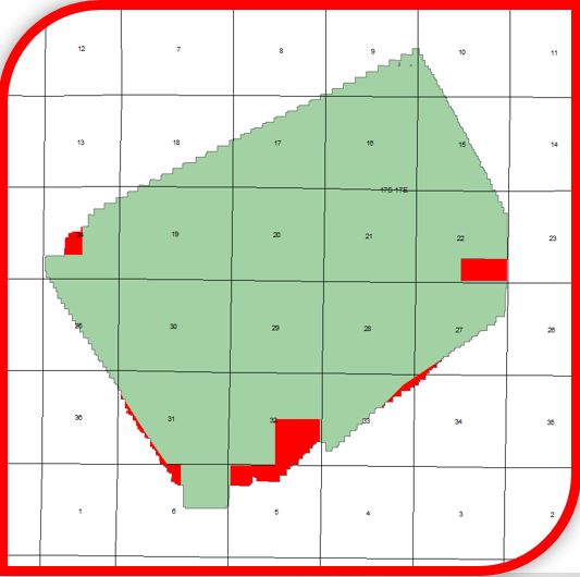
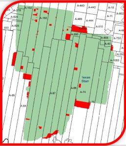
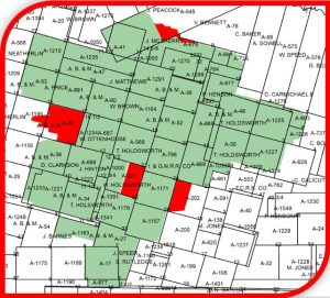
El Sauz 3D (2009 Original Processing) – 113.89 square miles Starr County, Texas
Pedernales 3D (2010 Original Processing) – 38.84 square miles Zavala County, Texas
Cliffside 3D (2003 Reprocessing) – 14.65 square miles McKenzie County, North Dakota

Rhoades 3D (2006 Reprocessing) – 12.31 square miles McKenzie County, North Dakota
Capone 3D (2013 Reprocessing) – 7.03 square miles Crook County, Wyoming
Additional information and shapefiles are available upon request or by visiting our interactive map at www.seismicexchange.com.
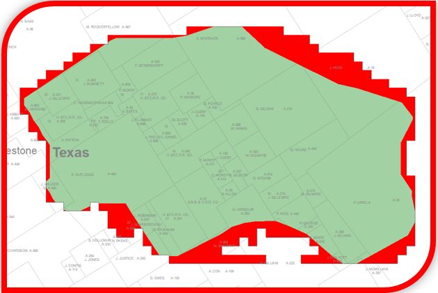
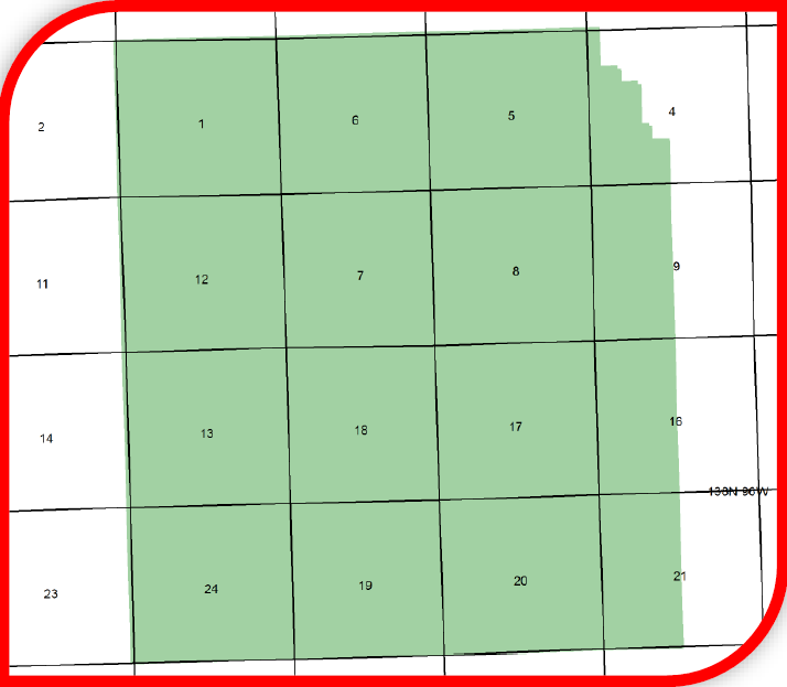
Seismic Exchange, Inc. is pleased to announce the release of the Tippie Ranch 3D survey, which comprises 34.64 square miles located in Limestone County, Texas, that was recently acquired from New Horizon Global, Inc. and is currently available for licensing.
Tippie Ranch 3D – 34.64 square miles
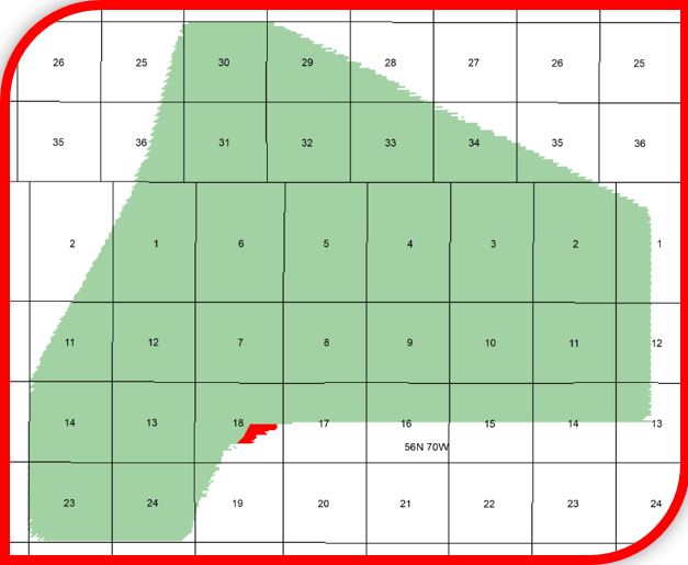
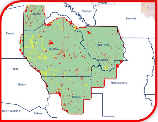
Seismic Exchange, Inc. is pleased to announce the release of the Haynesville 3D (2025 Reprocessing) which covers 1,794.96 square miles in Panola and Shelby Counties, Texas and Caddo, Bossier, Bienville, Red River, Sabine, De Soto and Natchitoches Parishes, Louisiana. The Haynesville 3D was reprocessed by In-Depth Geophysical, Inc. and is currently available for licensing.
Seismic Exchange, Inc. is pleased to announce the release of the Fort Peck 3D survey, which comprises 106.45 square miles located in Roosevelt & Richland Counties, Montana, that was recently acquired from Bryce Phillips and is currently available for licensing.
Fort Peck 3D – 106.45 square miles
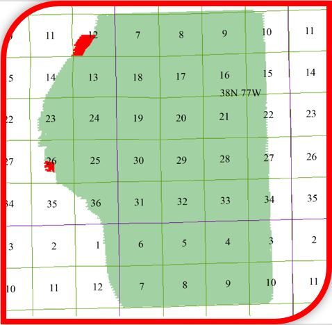
Seismic Exchange, Inc. is pleased to announce the release of the following 3D surveys that were recently acquired from JOG Corporation and are currently available for licensing.
North Dakota
Ash Creek 3D Survey (1995 Original Processing) – 13.71 square miles (Stark County)
Clay Butte 3D Survey (1995 Original Processing) – 71.76 square miles (Stark County)

County Line 3D Survey (1994 Original Processing) – 2.5 square miles (Stark & Dunn Counties)*
*(no processed data is available only field data and support)

Divide 3D Survey (1998 Merged Original Processing) – 52.06 square miles (Divide & Williams Counties)

Killdeer 3D Survey (1995 Original Processing) – 41.42 square miles (Dunn County)

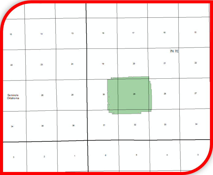
Seminole County, Oklahoma
Salt Creek 3D Survey (1987 Original Processing) – 1.65 square miles