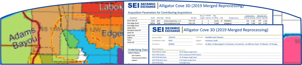
3D Survey Info Sheets
A “3D Survey Info Sheet” is available for each of our 3D surveys, directly from our GIS mapping screen on the website. The 3D Survey Info Sheet provides you with the following information in a PDF format:
- Map of the survey area or contributing surveys of a merged volume
- Seismic products included with the license of the latest processed volume of the 3D survey
- Acquisition parameters for the survey or contributing surveys of a merged volume
To download a 3D Survey Info Sheet, simply zoom in to the targeted survey on our GIS mapping screen, hover your mouse over it, and you will be prompted with a link to download and save the 3D Survey Info Sheet in PDF format on your computer.